AqUavplant Dataset: A High-Resolution Aquatic Plant Classification and Segmentation Image Dataset Using UAV
Nov 1, 2024·,,,,,,,·
0 min read
Md Abrar Istiak
Razib Hayat Khan
Jahid Hasan Rony
MM Mahbubul Syeed
M Ashrafuzzaman
Md Rajaul Karim
Md Shakhawat Hossain
Mohammad Faisal Uddin
 Image credit: Nature Sci.Data
Abstract
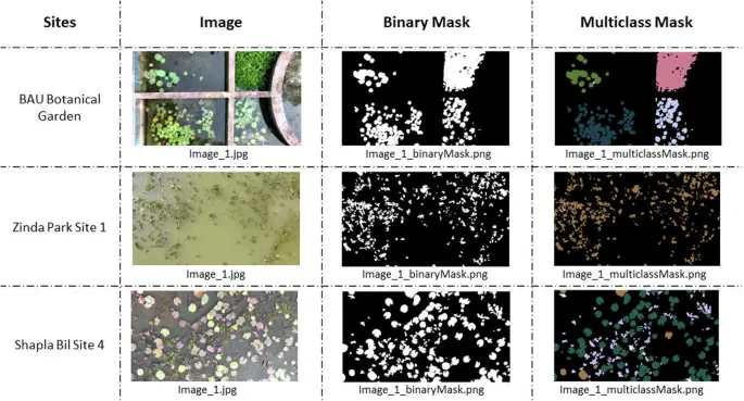
Aquatic vegetation species are declining gradually, posing a threat to the stability of aquatic ecosystems. The decline can be controlled with proper monitoring and mapping of the species for effective conservation and management. The Unmanned Ariel Vehicle (UAV) aka Drone can be deployed to comprehensively capture large area of water bodies for effective mapping and monitoring. This study developed the AqUavplant dataset consisting of 197 high resolution (3840px × 2160px, 4K) images of 31 aquatic plant species collected from nine different sites in Bangladesh. The DJI Mavic 3 Pro triple-camera professional drone is used with a ground sampling distance (GSD) value of 0.04-0.05 cm/px for optimal image collection without losing detail. The dataset is complemented with binary and multiclass semantic segmentation mask to facilitate ML based model development for automatic plant mapping. The dataset can be used to detect the diversity of indigenous and invasive species, monitor plant growth and diseases, measure the growth ratio to preserve biodiversity, and prevent extinction.
Type
Publication
Scientific Data